
Satellite
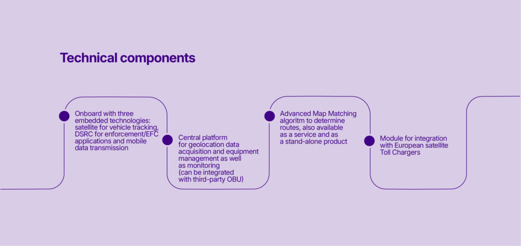
Toll system based on GNSS (satellite) OBU, which, through the mobile network, sends vehicle geolocation data to the central platform and calculates the amount due based on the traveled route.

Satellite System
In satellite-based systems, tolling is enabled through the use of GNSS (satellite) OBUs, which, via the mobile network, send vehicle geolocation data to the central platform.
Through a sophisticated Map Matching algorithm, the system processes the data and reconstructs the vehicle’s route, allowing for route verification and determining the amount due.
The platform is in use in most European toll domains, such as Italy, France, Spain, Portugal, Belgium, Poland, Austria, Germany, Denmark, Sweden, Norway, Hungary, Switzerland, Bulgaria, and on the roadmap for other countries.
Benefits for Manager and Advantages for Drivers

Toll calculation
based on the route and/or distance traveled

Interoperability
across European countries with a «One OBU, One Contract» approach

Advanced System
for reporting, monitoring, and diagnostics

Flexibility and adaptability
for integration with Toll Charger and Service Provider